Wednesday, July 7, 2010

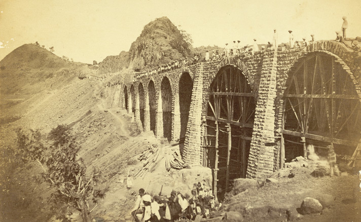
Railway Bridge on Bhore Ghaut Incline.--Photographer: Unknown Medium: Photographic print Date: 1855

https://www.prints-online.com/p/164/bhore-ghaut-incline-india-4406907.jpg.webpRailway Bridge on Bhore Ghaut Incline.

https://upload.wikimedia.org/wikipedia/en/1/1c/Railway_bridge_bhor_ghaut_incline1855.jpg
https://images-cdn.bridgemanimages.com/api/1.0/image/600wm.XXX.35785650.7055475/5655574.jpg

photograph of a view of the Bhore Incline, near Bombay from the 'Vibart Collection of Views in South India' taken by an unknown photographer about 1855. India’s vast railway network is an enduring legacy of the East India Company. In 1853 there were 32kms of tracks, whereas by 1948 there were nearly 50,000kms. The railway connecting Thana through the Thal and Bhor Ghat inclines was the initiative of George Clark, Chief Engineer of the Bombay Government. The Great Indian Peninsula Railway Company developed the scheme in the 1840s and the Bhor Ghat pass was opened in 1861 as the main route over the Western Ghats linking the sea coast with the Deccan.

https://images-cdn.bridgemanimages.com/api/1.0/image/600wm.XXX.25630330.7055475/3300473.jpg

 https://www.prints-online.com/p/164/bhore-ghaut-incline-india-4406907.jpg.webp

 https://c7.alamy.com/comp/J0FTJ4/viaduct-no1-at-3-14-miles-J0FTJ4.jpg

 https://c7.alamy.com/comp/DY5JXF/on-the-bhore-ghaut-laying-down-the-rails-DY5JXF.jpg

Khandalla from the Tank; railway cutting; Delmont and Elphinstone Point; at 13 miles

https://c7.alamy.com/comp/2M96FMW/khandalla-from-the-tank-railway-cutting-delmont-and-elphinstone-point-at-13-miles-2M96FMW.jpg


REVERSING STATION, BHORE GHAT INCLINE, G. I. RAILWAY. from the Article RAILWAY LOCATION AND SURVEYS IN RAJPUTANA, INDIA. By C. H. Croudace. from The Engineering Magazine Devoted to Industrial Progress Volume XVI October 1898 - March 1899 The Engineering Magazine Co Rājputana, meaning Land of the Rajputs, was a region in the Indian subcontinent that included mainly the present-day Indian state of Rajasthan, as well as parts of Madhya Pradesh and Gujarat, and some adjoining areas of Sindh in modern-day southern Pakistan.

Captions are provided by our contributors.

https://c7.alamy.com/comp/2X4CJDR/reversing-station-bhore-ghat-incline-g-i-railway-from-the-article-railway-location-and-surveys-in-rajputana-india-by-c-h-croudace-from-the-engineering-magazine-devoted-to-industrial-progress-volume-xvi-october-1898-march-1899-the-engineering-magazine-co-rjputana-meaning-land-of-the-rajputs-was-a-region-in-the-indian-subcontinent-that-included-mainly-the-present-day-indian-state-of-rajasthan-as-well-as-parts-of-madhya-pradesh-and-gujarat-and-some-adjoining-areas-of-sindh-in-modern-day-southern-pakistan-2X4CJDR.jpg


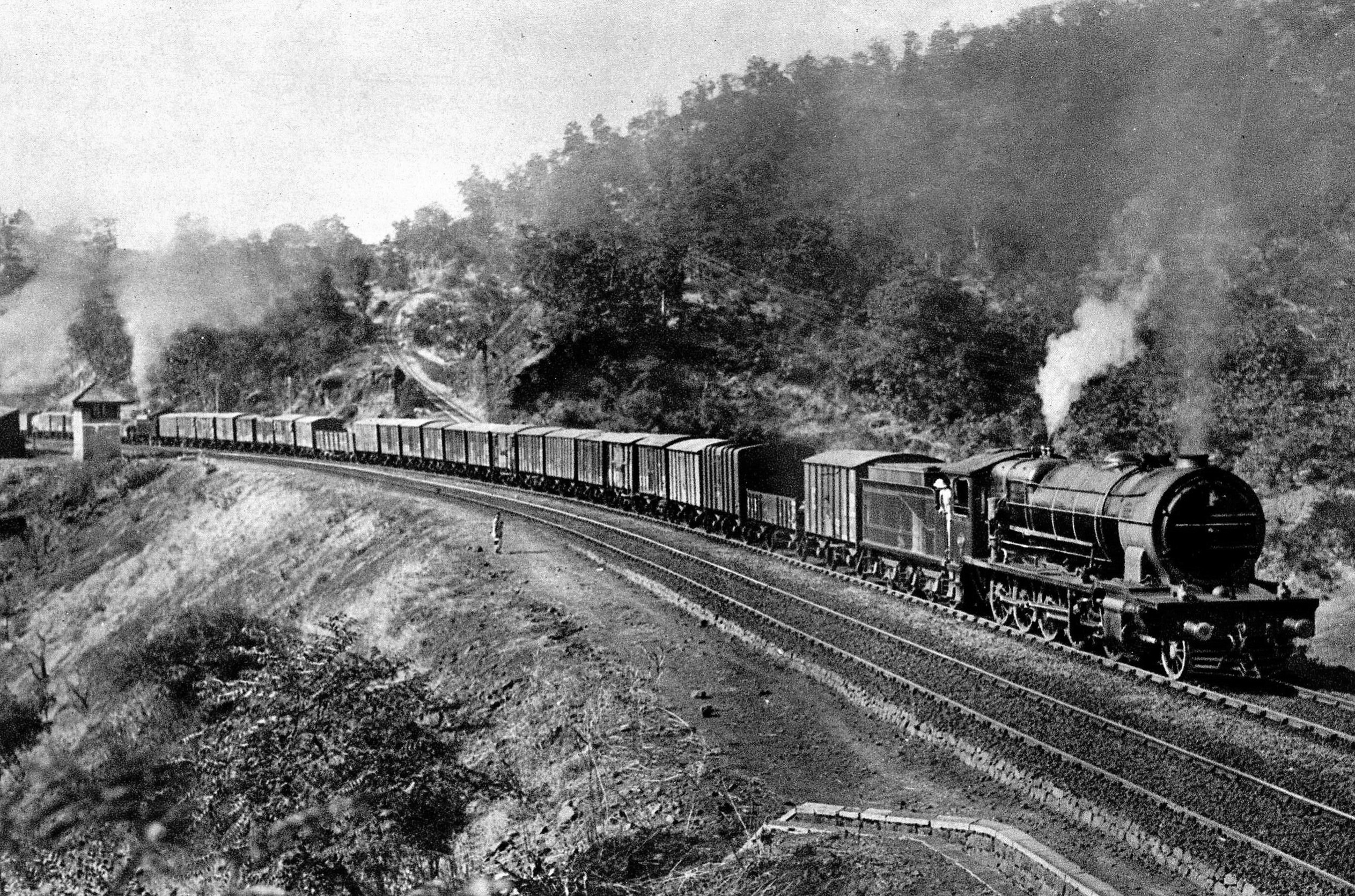
Bhore ghat incline

https://c7.alamy.com/comp/2M3NGMB/the-reversing-station-on-the-bhore-ghaut-incline-at-the-time-of-its-construction-the-bhore-ghaut-incline-was-the-highest-and-longest-railway-incline-in-the-world-rising-1832-feet-over-16-miles-there-is-one-point-along-the-line-where-to-gain-height-the-railway-sweeps-along-the-face-of-the-mountain-and-as-there-is-no-space-to-turn-round-a-reversing-station-was-formed-where-a-new-engine-would-be-attached-so-that-which-was-the-end-of-the-train-becomes-the-head-and-it-then-ascends-a-similar-incline-like-one-shelf-above-another-1869-2M3NGMB.jpg

https://images-cdn.bridgemanimages.com/api/1.0/image/600wm.XXX.35785650.7055475/5655574.jpg

https://upload.wikimedia.org/wikipedia/commons/7/7a/Great_Indian_Peninsula_Railway_-_Climbing_the_Ghaut_Inclines.jpg

No comments: